An overview of the collection, the legend of Quivira,
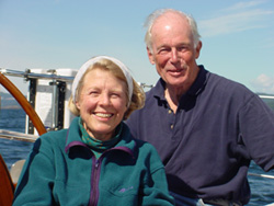
and special notes from owners Holly and Henry Wendt
The maps and illustrations in the Quivira Collection date from 1540 to 1802, a span of 260 years or so. These dates also bracket a period of history unprecedented for the general expansion of knowledge and information. The first application of the new technology of printing to maps and geographical knowledge coincides almost exactly with Columbus’s first voyage in 1492. Thus the maps in this collection span the transition from the European Renaissance to the Age of Enlightenment and bear eloquent testimony to the expansion of useful knowledge. The collection portrays the following significant exploratory events:
- Fact and Fantasy, the Earliest Explorers and the Legend of Quivira (mid 1500′s to mid 1700′s)
- California as an Island (mid 1600’s to late 1700’s)
- Secret Russian Explorations in the Pacific (1752 – 1775)
- Captain James Cook’s Voyages to the North Pacific (late 1700’s)
- In The Wake of Captain James Cook (late 1700’s)
- Overland to the Pacific (late 1700’s)
The mapmakers and their origins, including Germany, Italy, Northern Europe, and England, provide a sampling of the history of cartography in Europe from the mid 1600′s to the late 1800′s. Collectively, the maps constitute a significant representation of European knowledge of the northwest coast of America at their respective times. Some are quite rare, and all are works of art as much as compendiums of knowledge.
Listen to an audio introduction (mp3) of the collection provided by Antenna Audio.
Overview of Mapping the Pacific Coast
Notes on the Collection, from owners Henry and Holly Wendt ~
In a general sense, maps are as old as mankind. The desire, perhaps even the primordial urge, to illustrate in some manner a location relative to its surroundings or a journey across land and water reaches deep into human prehistory. The first depictions were literally bird’s-eye views, that is, pictures as seen from above showing various elements and their spatial relationship to one another. The oldest representation of this kind is a wall painting (discovered in 1963, in a prehistoric site in Anatolia dating from between 6100 and 6300 B.C.) that shows a general plan of a village and the immediate surroundings. Later plans—or maps—were sketched on papyrus by Egyptians and on clay tablets by Assyrians. Even to this day, ocean navigators in Micronesia use rather abstract but remarkably accurate sea charts made of woven coconut fibers and strategically placed sea shells to depict the spatial relationships of ocean currents, depths, and islands.
It is not surprising that maps hold a fascination for many people. They condense into one single document an immense amount of information: historical, topographical, geographical, and navigational. Maps are often presented in an artistic fashion that appeal to our senses as much as to our intellect. Moreover, most maps have tales to tell. To the careful observer, they tell very human stories of the early explorers and navigators, of men driven by insatiable curiosity, ambition, greed, or faith, of the first encounters with native inhabitants, of dreams and fantasies, sometimes lies and tricks, and even ambitions for national expansion and empire.
Over the years these early maps were preserved in libraries and private collections, bound in books or atlases and so perfectly protected from light and air; as with wine, light and air are two primary enemies of preservation. Some of these maps are now quite rare and it is increasingly difficult for a private collector to compete with universities and publicly supported institutions for their possession. Fortunately, our personal interest in the history of exploration—and particularly the history of exploration of the North Pacific—began over forty years ago. We acquired our first map in 1962. And it may not be entirely coincidental that we personally have sailed our fifty-five-foot sloop up the coast from San Francisco Bay as far north as Cross Sound and Icy Strait in southeast Alaska, thereby retracing the voyages of many of the first explorers and experiencing our own adventures of discovery.
We hope you enjoy these maps and the stories they tell. At the time they were drawn, engraved, and printed, the west coast of North America was truly remote from the world’s centers of knowledge and learning. For most of the early explorers, it took a year or more just to get here. The west coast of North America was literally the “edge of the world” and one of the last regions to be explored and mapped.
